
| 

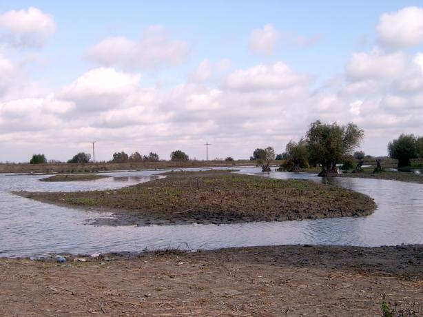
The locality is placed in the Jurilovca – Ceamurlia de Jos Depression, at the south-western extremity of the Babadag Plateau. It is a zone of marshes, meadows and cultivated lands. The village is bounded at south by Goloviţa Lake and at east by Razim Lake. Both lakes together with Babadag Lake form the Razim lakes complex, located on an ancient depression place which was flooded by the sea water. The highest parts of this depression remained as rocky isles or promontories. Bisericuţa isle is part of Periteaşca-Bisericuţa-Gura Portiţei Natural Reserve. Grădişte isle, 14.6 m high, is linked by the shore at the northern side. Popina isle, 47.9 m high, is the most commanding by position, extent and landscape beauty. Cape Dolojman, 7 km east from Jurilovca, 56 m high, has the highest cliff of the Romanian shore.
The vegetation is specific for the marsh (reed, bulrush and Dutch rush).
All these sites are recognized as ornithological natural reserves. These places constitute important shelters for many migratory species: pelicans, winter wild duck at other passage birds.
Razim Lake is one of the biggest fishing basins in the country. Ichthyofauna is represented by fresh water fish (carp, bream, sander etc.).
The climate is characterized by year average temperatures of 11°C. The precipitations are generally reduced (400 mm/year). The main winds are the northern and northeastern ones, but in summer the southern and southeastern ones dominate.
There is no natural or human factor to produce any major modification to the landscape.